 This year we have been working on the Hiking merit badge which requires the scouts to do five 10 mile hikes in preparation for a 20-miler. Most of the slot canyon hikes are shorter than 10 miles even if you do a loop of two canyons. In order to do a 10-miler we settled on a hike in the vicinity of Devils Canyon and the San Rafael Knob.
This is more of an open country hike. It's hard to imagine how anyone ever scraped out a life in this arid high mountain desert.

Recreation in the Swell is a point of serious contention right now. The BLM recently released an updated management plan, and have closed some sensitive routes to vehicular travel. Even though I am primarily a cyclist and backpacker, I can see the allure of ATV recreation, especially in areas like the Swell. The area is crisscrossed by old ranching an mining roads. But when I see something like this, I can't help but feel that the ATV crowd deserves even more restrictions unless they can find a way to police their own.
 The blatant abuse of a posted Wilderness Study Area is very offensive to me. There are literally hundreds of miles of trails and roads open in the Swell. The route closures should absolutely be honored.
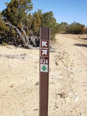
Then again, some of these signs aren't the clearest route markers in the world.

The San Rafael Knob is the highest point in the swell. From where we started it would have been a 12-14 mile round trip, so this is as close as we got.
 All in all, it was a nice hike. It helped that I had some of my best friends along as adult leaders.
On the way back to camp we tagged two great geocaches. If you are in the are you have to try and find Where in the Swell Am I and If you don't, Hoo Doo?. There are a lot of caches in the area, but many are much easier to find if you have an ATV to get you closer.

No comments:
Post a Comment